Public Safety · 2026
ThaiRescueMap
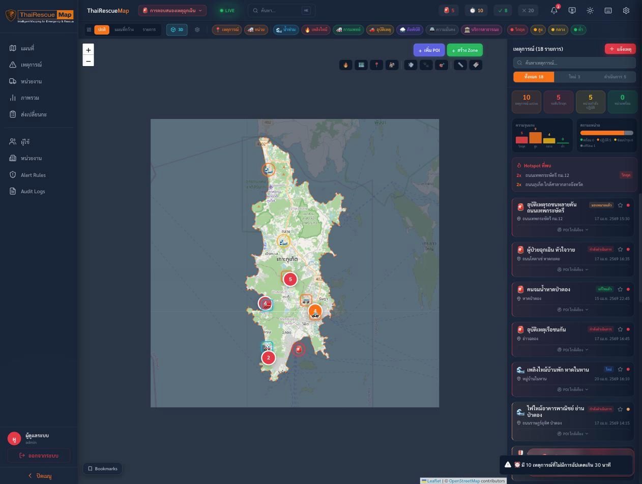
The operator side of a multi-agency emergency platform: one live map that fuses incident reports, unit positions, and risk layers so a command center sees the whole province and dispatches in seconds. Built as an installable PWA with a 2D Leaflet map and a 3D MapLibre view, realtime updates over SignalR, live CCTV, and a tsunami inundation simulator for the coastline.
At a glance
- 25
Operator screens
- SignalR
Realtime dispatch
- 5
Tsunami scenarios
The challenge
When a province faces a flood, a fire, or a mass-casualty incident, the people coordinating the response are often working from radios, phone calls, and separate systems. No one sees the whole picture at once.
Our approach
- One live operational map layering incidents, unit positions, risk zones, and points of interest
- Realtime updates over SignalR, so every operator sees the same state the moment it changes
- A 2D Leaflet map for daily work and a 3D MapLibre view for terrain and situational awareness
- Live CCTV, zone drawing, and a tsunami inundation simulator for the coastline
- Built as an installable PWA with a full mock-data mode, so it runs and demos without the backend
The result
A command center where an operator can spot an incident, dispatch the nearest unit, and watch it move, all from one screen.
Gallery
Brochure